

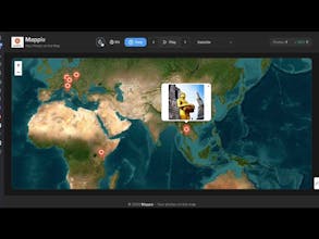
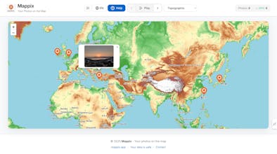
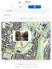
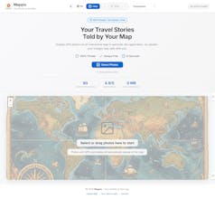
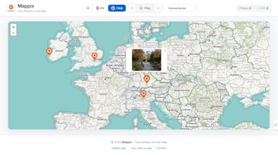
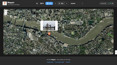
Mappix helps you visualize GPS-tagged photos on an interactive map with zero uploads. 🗺️ Drop your photos with GPS data and instantly see them plotted on a map. Perfect for travel memories or any photo collection. 🔒 PRIVACY-FIRST: All processing happens in your browser. ✨ FEATURES: • Automatic EXIF GPS extraction • 7 beautiful map styles • Reverse geocoding (city/street names) • Chronological playback • Dark/light theme • Bilingual (English/Hungarian) • 100% free, forever


👋 Hi Product Hunt! I'm László, creator of Mappix
I built this because I was frustrated with how hard it is to visualize where photos were taken. Most photo apps show you
a list or grid, but they don't give you the geographic story.
🗺️ What makes Mappix different:
- Zero upload, zero signup - Everything stays in your browser
- Instant clustering - See photo density at a glance
- Smart geocoding - Not just coordinates, but actual place names
- Works offline - Perfect for travel planning or organizing old photos
- Privacy-first - Your photos never leave your device
🔧 Technical highlights:
- Built with vanilla JavaScript (no heavy frameworks)
- Leaflet.js for smooth map interactions
- EXIF parsing happens client-side
- Responsive design that works on mobile and desktop
💡 Use cases I love:
- Planning travel routes by visualizing past trips
- Finding photos from specific neighborhoods or cities
- Organizing years of photos by location
- Discovering patterns in where you take photos
I'd love to hear how you'd use it! What features would make this more useful for your workflow?
Try it out and let me know what you think! 🚀